
Subang Jaya topographic map
Interactive map
Click on the map to display elevation.
About this map
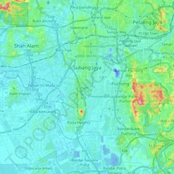
Name: Subang Jaya topographic map, elevation, terrain.
Location: Subang Jaya, Petaling, Selangor, Malaysia (2.97627 101.54887 3.08532 101.73094)
Average elevation: 27 m
Minimum elevation: -47 m
Maximum elevation: 198 m
Other topographic maps
Click on a map to view its topography, its elevation and its terrain.
Hulu Kelang
Malaysia > Selangor > Ampang Jaya Municipal Council > Hulu Kelang
Average elevation: 147 m