
Kuala Lumpur International Airport topographic map
Interactive map
Click on the map to display elevation.
About this map
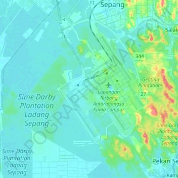
Name: Kuala Lumpur International Airport topographic map, elevation, terrain.
Location: Kuala Lumpur International Airport, Selangor, 64000, Malaysia (2.67992 101.63308 2.80350 101.74904)
Average elevation: 13 m
Minimum elevation: -1 m
Maximum elevation: 88 m
Other topographic maps
Click on a map to view its topography, its elevation and its terrain.
Selayang Municipal Council
Given its varied topography pattern and close proximity to the Titiwangsa Mountains (Banjaran Titiwangsa), Selayang is a mix of urban and countryside sceneries. Its premier natural attraction, which is well known across the country, is the Forest Research Institute Malaysia (FRIM), also known as FRIM Kepong.…
Average elevation: 236 m
Hulu Kelang
Malaysia > Selangor > Ampang Jaya Municipal Council > Hulu Kelang
Average elevation: 147 m