
寿阳县 topographic map
Interactive map
Click on the map to display elevation.
About this map
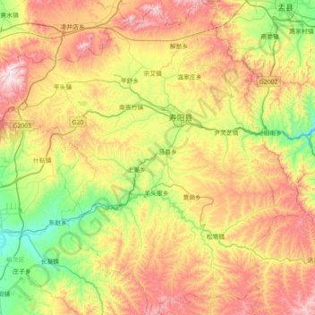
Name: 寿阳县 topographic map, elevation, terrain.
Location: 寿阳县, 晋中市, 山西省, 中国 (37.53807 112.75659 38.09630 113.45152)
Average elevation: 1,167 m
Minimum elevation: 779 m
Maximum elevation: 1,743 m
Other topographic maps
Click on a map to view its topography, its elevation and its terrain.