
Delano Peak topographic map
Interactive map
Click on the map to display elevation.
About this map
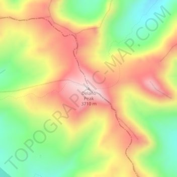
Name: Delano Peak topographic map, elevation, terrain.
Location: Delano Peak, Piute County, Utah, VS (38.36909 -112.37137 38.36919 -112.37127)
Average elevation: 3,447 m
Minimum elevation: 3,182 m
Maximum elevation: 3,707 m
Other topographic maps
Click on a map to view its topography, its elevation and its terrain.
Zion National Park
Zion National Park, West Rim Trail, Washington County, Utah, VS
Average elevation: 1,877 m
Capitol Reef National Park
Capitol Reef National Park, Notom To Oak Creek Road, Garfield County, Utah, VS
Average elevation: 1,963 m
Canyonlands National Park
Canyonlands National Park, Wayne County, Utah, VS
Average elevation: 1,640 m