
Kaohsiung topographic map
Interactive map
Click on the map to display elevation.
About this map
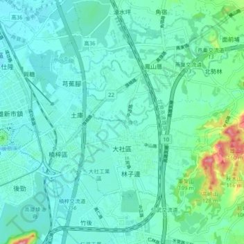
Name: Kaohsiung topographic map, elevation, terrain.
Location: Kaohsiung, 大社區, 815, Taïwan (22.70910 120.33412 22.76645 120.41190)
Average elevation: 29 m
Minimum elevation: 4 m
Maximum elevation: 148 m
Other topographic maps
Click on a map to view its topography, its elevation and its terrain.