
Mount Humphreys topographic map
Interactive map
Click on the map to display elevation.
About this map
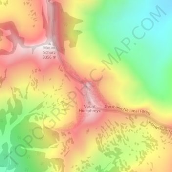
Name: Mount Humphreys topographic map, elevation, terrain.
Location: Mount Humphreys, Park County, Wyoming, VS (44.33545 -110.06329 44.33555 -110.06319)
Average elevation: 2,970 m
Minimum elevation: 2,523 m
Maximum elevation: 3,386 m
Other topographic maps
Click on a map to view its topography, its elevation and its terrain.
Yellowstone National Park
Yellowstone National Park, Mary Mountain-Nez Perce, Teton County, Wyoming, VS
Average elevation: 2,450 m
Rock Springs
VS > Wyoming > Rock Springs
Rock Springs, Sweetwater County, Wyoming, 82901, VS
Average elevation: 2,011 m
Grand Teton National Park
Grand Teton National Park, Teton Park Road, Teton County, Wyoming, 83013, VS
Average elevation: 2,409 m