Geolocate

Jessheim topographic map

Click on the map to display elevation.

About this map

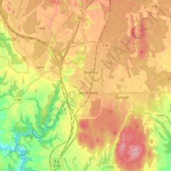
Name: Jessheim topographic map, elevation, terrain.

Location: Jessheim, Ullensaker, Viken, 2066, Norway (60.10151 11.13515 60.18151 11.21515)

Average elevation: 191 m

Minimum elevation: 109 m

Maximum elevation: 264 m

Other topographic maps

Click on a map to view its topography, its elevation and its terrain.

Aremark

Norway > Viken

Average elevation: 150 m

Hemsedal

Norway > Viken

Average elevation: 1,217 m

Rollag

Norway > Viken

Average elevation: 652 m

Nordre Follo

Norway > Viken

Average elevation: 142 m

Fødalen landskapsvernområde

Norway > Viken

Average elevation: 1,483 m

Indre Østfold

Norway > Viken

Average elevation: 148 m

Moss

Norway > Viken

Average elevation: 23 m

Drammen

Norway > Viken

Average elevation: 209 m

Hvaler

Norway > Viken

Average elevation: 2 m

Nittedal

Norway > Viken

Average elevation: 296 m

Flå

Norway > Viken

Average elevation: 719 m

Gear up for your next adventure:

🥤Outdoor Water Bottles - Reusable bottles for outdoor activities
📣High-Decibel Survival Whistles - Signaling tool for rescue that carries much further than a human voice
🧭Military Style Lensatic Compass - Durable sighting compasses for advanced land navigation and surveying
🐍Australian Snake Bite Kits - Specific pressure immobilization bandages for Australian venomous snakes
🧤Thermal Hiking Gloves - Keep your hands warm and functional during high-altitude winter treks

As an Amazon Associate, this site earns from qualifying purchases at no extra cost to you.