
Nassau topographic map
Interactive map
Click on the map to display elevation.
About this map
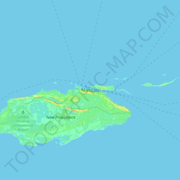
Name: Nassau topographic map, elevation, terrain.
Location: Nassau, New Providence, The Bahamas (24.91823 -77.49834 25.23823 -77.17834)
Average elevation: 1 m
Minimum elevation: 0 m
Maximum elevation: 35 m
Other topographic maps
Click on a map to view its topography, its elevation and its terrain.
Russell Island
Russell Island, Spanish Wells, The Bahamas
Average elevation: 1 m
Village Green
Village Green, New Providence, The Bahamas
Average elevation: 7 m
Regency Park
Regency Park, New Providence, The Bahamas
Average elevation: 7 m
Coconut Grove
The Bahamas > Coconut Grove > New Providence
Coconut Grove, New Providence, The Bahamas
Average elevation: 8 m
Grand Bahama
The Bahamas > East Grand Bahama
Grand Bahama, East Grand Bahama, The Bahamas
Average elevation: 1 m