
South Andros topographic map
Interactive map
Click on the map to display elevation.
About this map
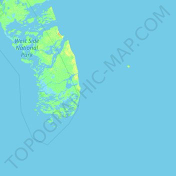
Name: South Andros topographic map, elevation, terrain.
Location: South Andros, The Bahamas (23.36200 -78.10519 24.43601 -76.86608)
Average elevation: 0 m
Minimum elevation: -2 m
Maximum elevation: 20 m
Other topographic maps
Click on a map to view its topography, its elevation and its terrain.
Russell Island
Russell Island, Spanish Wells, The Bahamas
Average elevation: 1 m
Village Green
Village Green, New Providence, The Bahamas
Average elevation: 7 m
Regency Park
Regency Park, New Providence, The Bahamas
Average elevation: 7 m
Coconut Grove
The Bahamas > Coconut Grove > New Providence
Coconut Grove, New Providence, The Bahamas
Average elevation: 8 m
Grand Bahama
The Bahamas > East Grand Bahama
Grand Bahama, East Grand Bahama, The Bahamas
Average elevation: 1 m