
Horace topographic map
Interactive map
Click on the map to display elevation.
About this map
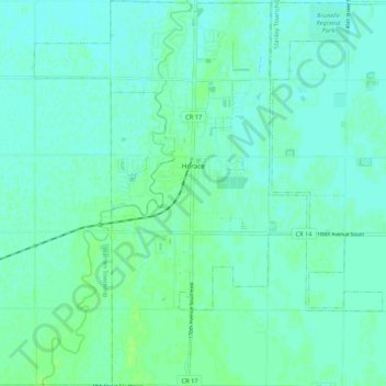
Name: Horace topographic map, elevation, terrain.
Location: Horace, Cass County, North Dakota, United States (46.71719 -96.94762 46.79008 -96.87234)
Average elevation: 278 m
Minimum elevation: 275 m
Maximum elevation: 283 m
Other topographic maps
Click on a map to view its topography, its elevation and its terrain.
Fargo
United States > North Dakota > Cass County
Fargo, Cass County, North Dakota, United States
Average elevation: 277 m
Kindred
United States > North Dakota > Cass County
Kindred, Cass County, North Dakota, United States
Average elevation: 288 m
Fargo
United States > North Dakota > Cass County > Fargo
Fargo, Cass County, North Dakota, 58102-4608, United States
Average elevation: 277 m
Harwood
United States > North Dakota > Cass County > Harwood
Harwood, Cass County, North Dakota, 58042, United States
Average elevation: 272 m