
Corva topographic map
Interactive map
Click on the map to display elevation.
About this map
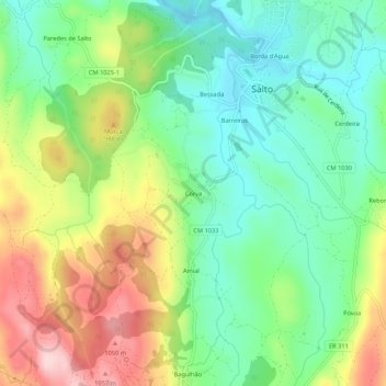
Name: Corva topographic map, elevation, terrain.
Location: Corva, Salto, Montalegre, Vila Real, 5470-430, Portugal (41.60894 -7.97559 41.64894 -7.93559)
Average elevation: 905 m
Minimum elevation: 802 m
Maximum elevation: 1,074 m
Other topographic maps
Click on a map to view its topography, its elevation and its terrain.