
Comanche County topographic map
Interactive map
Click on the map to display elevation.
About this map
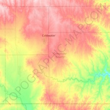
Name: Comanche County topographic map, elevation, terrain.
Location: Comanche County, Kansas, VS (36.99922 -99.54351 37.38493 -99.00068)
Average elevation: 595 m
Minimum elevation: 491 m
Maximum elevation: 699 m
Other topographic maps
Click on a map to view its topography, its elevation and its terrain.