
Barton County topographic map
Interactive map
Click on the map to display elevation.
About this map
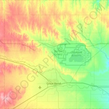
Name: Barton County topographic map, elevation, terrain.
Location: Barton County, Kansas, VS (38.26030 -99.03337 38.69722 -98.48089)
Average elevation: 578 m
Minimum elevation: 532 m
Maximum elevation: 651 m
Other topographic maps
Click on a map to view its topography, its elevation and its terrain.