
Ben Lomond topographic map
Interactive map
Click on the map to display elevation.
About this map
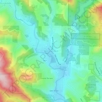
Name: Ben Lomond topographic map, elevation, terrain.
Average elevation: 210 m
Minimum elevation: 87 m
Maximum elevation: 502 m
Other topographic maps
Click on a map to view its topography, its elevation and its terrain.
Pleasure Point
United States > California > Santa Cruz County
Pleasure Point, Santa Cruz County, California, United States
Average elevation: 6 m
Santa Cruz
United States > California > Santa Cruz County
Santa Cruz, Santa Cruz County, CAL Fire Northern Region, California, United States
Average elevation: 89 m
Bonny Doon
United States > California > Santa Cruz County
Bonny Doon, Santa Cruz County, CAL Fire Northern Region, California, 94050, United States
Average elevation: 367 m
Paradise Park
United States > California > Santa Cruz County > Paradise Park
Paradise Park, Santa Cruz County, CAL Fire Northern Region, California, 95064, United States
Average elevation: 145 m
Mount Hermon
United States > California > Santa Cruz County > Felton > Mount Hermon
Mount Hermon, Felton, Santa Cruz County, California, 95041, United States
Average elevation: 154 m