Geolocate

Trinity topographic map

Click on the map to display elevation.

About this map

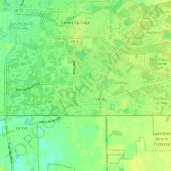
Name: Trinity topographic map, elevation, terrain.

Location: Trinity, Pasco County, Florida, 35655, United States (28.17325 -82.70017 28.19830 -82.61928)

Average elevation: 10 m

Minimum elevation: -1 m

Maximum elevation: 17 m

Other topographic maps

Click on a map to view its topography, its elevation and its terrain.

Odessa

United States > Florida > Pasco County > Odessa

Average elevation: 17 m

Hudson

United States > Florida > Pasco County > Hudson

Average elevation: 5 m

Forest Hills

United States > Florida > Pasco County > Holiday

Average elevation: 4 m

Dade City

United States > Florida > Pasco County

Dade City contains gently rolling topography with elevations from 60 ft to 100 ft.

Average elevation: 33 m

Hudson

United States > Florida > Pasco County

Average elevation: 4 m

Saint Leo

United States > Florida > Pasco County

St. Leo contains rolling hills with elevations from 100 ft to 180 ft.

Average elevation: 46 m

Anclote

United States > Florida > Pasco County

Average elevation: 4 m

Elfers

United States > Florida > Pasco County > Elfers

Average elevation: 5 m

Gear up for your next adventure:

🧤Hiking Gloves - Protective gloves for outdoor use
🍴Titanium Spork & Cutlery - Indestructible and feather-light eating utensils
🧦Hiking Socks - Comfortable socks for long hikes
📱Shockproof Phone Cases - Extra protection for your smartphone against drops on rocky terrain
📚Map Reading & Navigation Guides - Master the art of interpreting topographic contours and symbols

As an Amazon Associate, this site earns from qualifying purchases at no extra cost to you.