
Glodeni topographic map
Interactive map
Click on the map to display elevation.
About this map
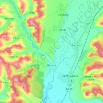
Name: Glodeni topographic map, elevation, terrain.
Location: Glodeni, Targu Mures Metropolitan Area, Mureș, Romania (46.62168 24.48634 46.71187 24.63378)
Average elevation: 382 m
Minimum elevation: 319 m
Maximum elevation: 515 m
Other topographic maps
Click on a map to view its topography, its elevation and its terrain.
Târgu Mureș
Târgu Mureș, Targu Mures Metropolitan Area, Mureș, Romania
Average elevation: 357 m
Transylvania
Transylvania, Band, Mureș, 547065, Romania
Average elevation: 648 m