
Vidago (União das freguesias de Vidago, Arcossó, Selhariz e Vilarinho das Paranheiras) topographic map
Interactive map
Click on the map to display elevation.
About this map
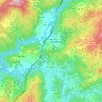
Name: Vidago (União das freguesias de Vidago, Arcossó, Selhariz e Vilarinho das Paranheiras) topographic map, elevation, terrain.
Average elevation: 444 m
Minimum elevation: 301 m
Maximum elevation: 737 m
Other topographic maps
Click on a map to view its topography, its elevation and its terrain.