
Oprișor topographic map
Interactive map
Click on the map to display elevation.
About this map
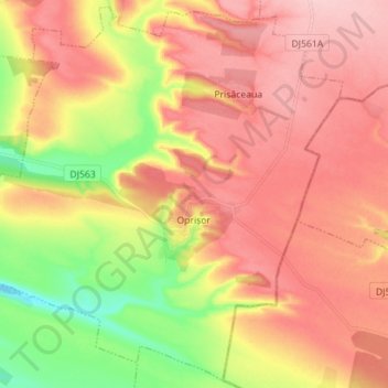
Name: Oprișor topographic map, elevation, terrain.
Location: Oprișor, Mehedinți, Romania (44.24295 22.99194 44.33998 23.13239)
Average elevation: 193 m
Minimum elevation: 103 m
Maximum elevation: 257 m
Other topographic maps
Click on a map to view its topography, its elevation and its terrain.