
Orșova topographic map
Interactive map
Click on the map to display elevation.
About this map
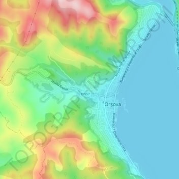
Name: Orșova topographic map, elevation, terrain.
Location: Orșova, Mehedinți, Romania (44.70972 22.37496 44.74176 22.41130)
Average elevation: 147 m
Minimum elevation: 62 m
Maximum elevation: 338 m
Other topographic maps
Click on a map to view its topography, its elevation and its terrain.