Emery County topographic map
Click on the map to display elevation.
Emery County
In 1853 John W. Gunnison, an Army Topographical Engineer came through Castle Valley, plotting a railroad route. He was commissioned for this assignment by the US Secretary of War Jefferson Davis. He left detailed descriptions of his travels and carefully laid out his route through Castle Valley. Gunnison's route first met the Spanish Trail at the Green River crossing. He followed this trail for a short distance west of the Green River, but when the Spanish Trail entered a rugged rocky region (Sinbad Reef) he charted a route around this feature.
About this map
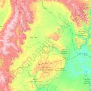
Name: Emery County topographic map, elevation, terrain.
Location: Emery County, Utah, United States (38.49993 -111.30708 39.70435 -109.98790)
Average elevation: 1,958 m
Minimum elevation: 1,205 m
Maximum elevation: 3,472 m
Other topographic maps
Click on a map to view its topography, its elevation and its terrain.

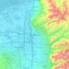
Salt Lake City
United States > Utah > Salt Lake County > Salt Lake City
Salt Lake City has an area of 110.4 square miles (286 km2) and an average elevation of 4,327 feet (1,319 m) above sea level. The lowest point within the boundaries of the city is 4,210 feet (1,280 m) near the Jordan River and the Great Salt Lake, and the highest is Grandview Peak, at 9,410 feet (2,868 m).
Average elevation: 1,625 m