Geolocate

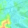
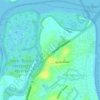
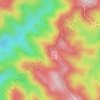
Whites Hill Reserve topographic map

Click on the map to display elevation.

Whites Hill Reserve

Whites Hill is named after Robert (Bob) White, who, in 1873, acquired 21.5 hectares (53 acres) of land surrounding the 120 metres (390 ft) elevation now known as Whites Hill. Halfway up the hill facing Coorparoo, the White family built their family home. In 1886, White installed a powerful telescope, which he allowed others to use.

About this map

Name: Whites Hill Reserve topographic map, elevation, terrain.

Location: Whites Hill Reserve, Canopus Street, Coorparoo, Brisbane City, Queensland, 4151, Australia (-27.51747 153.07291 -27.50396 153.09372)

Average elevation: 48 m

Minimum elevation: 12 m

Maximum elevation: 104 m

Queensland trails, hiking, mountain biking, running and outdoor activities

Other topographic maps

Click on a map to view its topography, its elevation and its terrain.

Mount Petrie

Australia > Queensland > Brisbane City

Average elevation: 58 m

Toohey Forest

Australia > Queensland > Brisbane City

Average elevation: 74 m

Teneriffe

Australia > Queensland > Brisbane City

Average elevation: 11 m

Oxley Creek

Australia > Queensland > Brisbane City

Average elevation: 13 m

Normanby

Australia > Queensland > Brisbane City > Normanby

Average elevation: 22 m

Rosalie

Australia > Queensland > Brisbane City

Average elevation: 30 m

Kooringal

Australia > Queensland > Brisbane City > Kooringal

Average elevation: 2 m

Kedron Brook

Australia > Queensland > Brisbane City

Average elevation: 22 m

Mount Crosby

Australia > Queensland > Brisbane City

Average elevation: 74 m

Swan Hill

Australia > Queensland > Brisbane City

Average elevation: 23 m

Giraween Park

Australia > Queensland > Brisbane City

Average elevation: 13 m

Constitution Hill

Australia > Queensland > Brisbane City

Average elevation: 144 m

Bulimba Creek

Australia > Queensland > Brisbane City

Average elevation: 10 m

Mowbray Park

Australia > Queensland > Brisbane City

Average elevation: 11 m

Moggill Creek

Australia > Queensland > Brisbane City

Average elevation: 28 m

Musgrave Park

Australia > Queensland > Brisbane City

Average elevation: 19 m

Blunder Creek

Australia > Queensland > Brisbane City

Average elevation: 15 m

Westridge Outlook

Australia > Queensland > Brisbane City

Average elevation: 370 m

Gear up for your next adventure:

🔑Heavy Duty Carabiners - Secure gear to the outside of your pack for easy access
🧼Biodegradable Outdoor Soap - Clean gear and yourself without harming the local ecosystem
🔭Compact Hiking Binoculars - Lightweight optics for scouting routes or birdwatching
🔥Ferrocerium Rod Fire Starters - Reliable fire lighting in wet or windy conditions without matches
🦯Adjustable Trekking Poles - Reduce impact on knees when descending steep topographic ridges

As an Amazon Associate, this site earns from qualifying purchases at no extra cost to you.