Geolocate

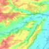
Burghfield Common topographic map

Click on the map to display elevation.

About this map

Name: Burghfield Common topographic map, elevation, terrain.

Location: Burghfield Common, West Berkshire, England, RG7 3ET, United Kingdom (51.37721 -1.08242 51.41721 -1.04242)

Average elevation: 81 m

Minimum elevation: 42 m

Maximum elevation: 102 m

Other topographic maps

Click on a map to view its topography, its elevation and its terrain.
Bradfield

United Kingdom > England > West Berkshire

Average elevation: 77 m

Speen

United Kingdom > England > West Berkshire

Average elevation: 106 m

Hungerford

United Kingdom > England > West Berkshire

Average elevation: 131 m

Great Shefford

United Kingdom > England > West Berkshire

Average elevation: 148 m

Gear up for your next adventure:

🥾Hiking Gaiters - Leg protection for trails
🧼Biodegradable Outdoor Soap - Clean gear and yourself without harming the local ecosystem
🦟Heavy Duty Insect Repellent - Essential protection against flies, mozzies, and march flies
🔦Headlamps - Hands-free lighting for hiking
🔌Fast Charging Adapters - Quickly top up all your gear before heading back into the field

As an Amazon Associate, this site earns from qualifying purchases at no extra cost to you.