
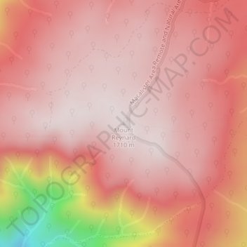
Mount Reynard topographic map
Click on the map to display elevation.
About this map
Name: Mount Reynard topographic map, elevation, terrain.
Location: Mount Reynard, Shire of Wellington, Victoria, Australia (-37.39687 146.72556 -37.39677 146.72566)
Average elevation: 1,573 m
Minimum elevation: 1,059 m
Maximum elevation: 1,711 m
Victoria trails, hiking, mountain biking, running and outdoor activities
Other topographic maps
Click on a map to view its topography, its elevation and its terrain.
City of Melbourne
Melbourne's topography is characterized by a diverse landscape that transitions from flat coastal plains to rolling hills and mountainous regions. The city is situated at the northern end of Port Phillip Bay, where the terrain is predominantly flat, facilitating urban development. As one moves eastward, the…
Average elevation: 18 m
Melbourne
Melbourne is also prone to isolated convective showers forming when a cold pool crosses the state, especially if there is considerable daytime heating. These showers are often heavy and can include hail, squalls, and significant drops in temperature, but they often pass through very quickly with a rapid…
Average elevation: 185 m
Grampians National Park
Mount William is known within the gliding community for the "Grampians Wave", a weather phenomenon that sometimes enables glider pilots to reach extreme altitudes of the order of 28,000 ft (8,500 m). This predominantly occurs during the months of May, June, September and October when strong westerly winds flow…
Average elevation: 262 m
Trentham
Trentham is a small town in the Shire of Hepburn and Shire of Moorabool local government area, Victoria, Australia. At the 2016 census, Trentham had a population of 1,180, with a median age of 55 years. Located at an altitude of 700 metres (2,297 ft), the town is 87 kilometres (54 mi) north-west of Melbourne.
Average elevation: 702 m
Castlemaine
The Castlemaine goldfields' legendary prosperity raised expectations of Castlemaine becoming Victoria's second city. That is reflected in imposing buildings erected in the town's first few years. Though the rich alluvial diggings were largely exhausted within 15–20 years causing the town's population to…
Average elevation: 319 m
Mount Buller
Due to its far south-western location in the alpine region, Mount Buller is more susceptible to cold airmasses which allow it to record some of the lowest maximum temperatures and daytime readings in the country, despite being considerably lower in elevation than other mountain sites to the north-east. On 5…
Average elevation: 824 m
Omeo
There are bus routes from Bright and Bairnsdale. The Bairnsdale bus runs weekdays, once both directions, and the Bright bus (Alps Link) timetable is less frequent in Summer and runs additional services during the ski season. Alps Link is the highest altitude public bus in Australia. The town sits at the…
Average elevation: 861 m
Albert Park
Heritage Victoria notes that Albert Park's St Vincent Gardens "is historically important as the premier 'square' development in Victoria based on similar models in London. It is significant as the largest development of its type in Victoria and for its unusual development as gardens rather than the more usual…
Average elevation: 6 m
Beaufort
Beaufort has an elevation-influenced oceanic climate (Köppen: Cfb), with tepid, relatively dry summers and cool, wetter winters. Average maxima vary from 25.3 °C (77.5 °F) in January to 10.1 °C (50.2 °F) in July, while average minima fluctuate between 11.5 °C (52.7 °F) in February and 3.2 °C (37.8 °F)…
Average elevation: 390 m
Horsham
Horsham's topography is flat, approximately 128 metres (420 ft) above sea level. The central business district (CBD) is laid out in a grid plan south of the train line and is characterised by wide streets and several roundabouts. Firebrace Street, running north–south through the middle of the CBD is one of…
Average elevation: 129 m
Yarra Ranges National Park
Australia > Victoria > Lake Mountain Alpine Resort
Average elevation: 465 m
Hamilton
Like most of south-western Victoria, Hamilton has a temperate mediterranean climate (Csb). Cold fronts regularly sweep in from the Southern Ocean. Although daytime temperatures occasionally reach into the 30s even 40s during summer, daytime temperatures in the mid teens will often linger into December and are…
Average elevation: 196 m