
Olary topographic map
Click on the map to display elevation.
About this map
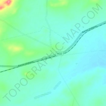
Name: Olary topographic map, elevation, terrain.
Average elevation: 283 m
Minimum elevation: 268 m
Maximum elevation: 350 m
Pastoral Unincorporated Area trails, hiking, mountain biking, running and outdoor activities
Other topographic maps
Click on a map to view its topography, its elevation and its terrain.
Dullingari
Australia > South Australia > Pastoral Unincorporated Area > Innamincka
Average elevation: 89 m
Bookabourdie Waterhole
Australia > South Australia > Pastoral Unincorporated Area > Innamincka
Average elevation: 44 m
Stokes Hill Lookout
Australia > South Australia > Pastoral Unincorporated Area
Average elevation: 684 m
Nullabor Plain
Australia > South Australia > Pastoral Unincorporated Area
One theory is that the whole area was uplifted by crustal movements in the Miocene, and since then, erosion by wind and rain has reduced its thickness. The plain has most likely never had any major defining topographic features, resulting in the extremely flat terrain across the plain today.
Average elevation: 117 m
Lyndhurst
Australia > South Australia > Pastoral Unincorporated Area > Lyndhurst
Average elevation: 133 m
Lake Macdonell
Australia > South Australia > Pastoral Unincorporated Area > Penong
Average elevation: 6 m
Mungerannie
Australia > South Australia > Pastoral Unincorporated Area > Mungerannie
Average elevation: 59 m
Leigh Creek
Australia > South Australia > Pastoral Unincorporated Area > Leigh Creek
Average elevation: 267 m
Fowlers Bay
Australia > South Australia > Pastoral Unincorporated Area > Fowlers Bay
Average elevation: 3 m