
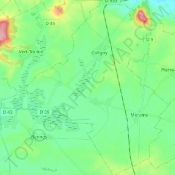
Val-des-Marais topographic map
Interactive map
Click on the map to display elevation.
About this map
Name: Val-des-Marais topographic map, elevation, terrain.
Average elevation: 150 m
Minimum elevation: 119 m
Maximum elevation: 239 m
Other topographic maps
Click on a map to view its topography, its elevation and its terrain.
Bisseuil
France > Grand Est > Marne > Aÿ-Champagne
Bisseuil se situe au pied de la montagne de Reims, dont les coteaux sont plantés de 125 hectares de vignes appartenant au vignoble de la vallée de la Marne. Le massif recouvre tout le nord de la commune. La vallée de la Crayère s'y avance, perpendiculairement au canal. Le village est dominé à l'est par…
Average elevation: 94 m
Mareuil-sur-Ay
France > Grand Est > Marne > Aÿ-Champagne
La partie la plus ancienne du village, à l'est, est construite à flanc de coteaux et est dominée par la statue Notre-Dame du Gruguet, à environ 130 mètres d'altitude. Les quartiers de l'ouest sont plus récents. Le quartier des Carelles, à l'ouest, est contigu à la ville d'Ay.
Average elevation: 91 m
Réserve biologique dirigée de Faux de Verzy
France > Grand Est > Marne > Verzy
Average elevation: 248 m
Blaise sous Hauteville
France > Grand Est > Marne > Sainte-Marie-du-Lac-Nuisement
Average elevation: 130 m
Montigny-sous-Chatillon
France > Grand Est > Marne > Châtillon-sur-Marne > Montigny-sous-Chatillon
Average elevation: 136 m