
Rørvika topographic map
Interactive map
Click on the map to display elevation.
About this map
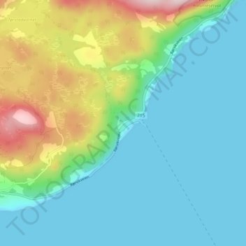
Name: Rørvika topographic map, elevation, terrain.
Location: Rørvika, Indre Fosen, Trøndelag, Norway (63.48895 10.11302 63.52895 10.15302)
Average elevation: 83 m
Minimum elevation: 0 m
Maximum elevation: 329 m
Other topographic maps
Click on a map to view its topography, its elevation and its terrain.