Geolocate

Gojam topographic map

Interactive map

Click on the map to display elevation.

About this map

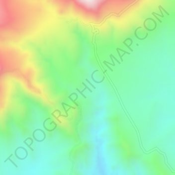
Name: Gojam topographic map, elevation, terrain.

Location: Gojam, Oromia, Amhara, Äthiopien (11.17333 39.89000 11.19333 39.91000)

Average elevation: 1,758 m

Minimum elevation: 1,573 m

Maximum elevation: 2,065 m

Other topographic maps

Click on a map to view its topography, its elevation and its terrain.

Satima

Äthiopien > Amhara

Satima, West-Godscham, Amhara, Äthiopien

Average elevation: 2,562 m

ደባርቅ

Äthiopien > Amhara

ደባርቅ, Nord-Gonder, Amhara, Äthiopien

Average elevation: 2,827 m

Manu

Äthiopien > Amhara

Manu, Nord-Gonder, Amhara, Äthiopien

Average elevation: 1,057 m

Kone ?

Äthiopien > Amhara

Kone ?, North Shewa (Amhara Region), Amhara, Äthiopien

Average elevation: 1,299 m

North Shewa (Amhara Region)

Äthiopien > Amhara

North Shewa (Amhara Region), Amhara, Äthiopien

Average elevation: 1,808 m

Macanna

Äthiopien > Amhara > Macanna

Macanna, Nord-Gonder, Amhara, Äthiopien

Average elevation: 3,458 m