
Pozieres topographic map
Interactive map
Click on the map to display elevation.
About this map
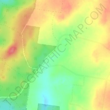
Name: Pozieres topographic map, elevation, terrain.
Location: Pozieres, Warwick, Queensland, 4370, Australia (-28.53750 151.85584 -28.51750 151.87584)
Average elevation: 936 m
Minimum elevation: 898 m
Maximum elevation: 970 m
Queensland trails, hiking, mountain biking, running and outdoor activities
Other topographic maps
Click on a map to view its topography, its elevation and its terrain.