
Agolada topographic map
Interactive map
Click on the map to display elevation.
About this map
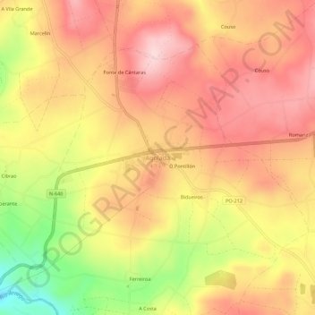
Name: Agolada topographic map, elevation, terrain.
Location: Agolada, Deza, Pontevedra, Galicia, 36520, España (42.74259 -8.03842 42.78259 -7.99842)
Average elevation: 569 m
Minimum elevation: 418 m
Maximum elevation: 660 m
Other topographic maps
Click on a map to view its topography, its elevation and its terrain.
Pontenoufe
Pontenoufe, A Xesta, Lalín, Deza, Pontevedra, Galicia, 36515, España
Average elevation: 567 m