
Anseremme topographic map
Interactive map
Click on the map to display elevation.
About this map
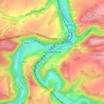
Name: Anseremme topographic map, elevation, terrain.
Location: Anseremme, Dinant, Namen, Wallonië, 5500, België (50.21791 4.88792 50.25791 4.92792)
Average elevation: 172 m
Minimum elevation: 75 m
Maximum elevation: 264 m
Other topographic maps
Click on a map to view its topography, its elevation and its terrain.