
Castillos topographic map
Interactive map
Click on the map to display elevation.
About this map
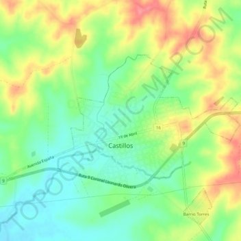
Name: Castillos topographic map, elevation, terrain.
Location: Castillos, Rocha, 27200, Uruguay (-34.20721 -53.88545 -34.18515 -53.83682)
Average elevation: 43 m
Minimum elevation: 9 m
Maximum elevation: 89 m
Other topographic maps
Click on a map to view its topography, its elevation and its terrain.
Pueblo Nuevo
Uruguay > Rocha > Pueblo Nuevo
Pueblo Nuevo, Rocha, 27400, Uruguay
Average elevation: 18 m
Barra de Valizas
Uruguay > Rocha > Barra de Valizas
Barra de Valizas, Rocha, 27200, Uruguay
Average elevation: 2 m