
Greenbrier River topographic map
Interactive map
Click on the map to display elevation.
About this map
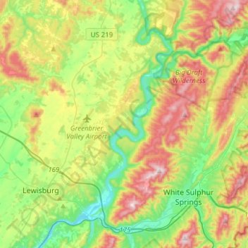
Name: Greenbrier River topographic map, elevation, terrain.
Average elevation: 698 m
Minimum elevation: 504 m
Maximum elevation: 1,008 m
Other topographic maps
Click on a map to view its topography, its elevation and its terrain.
Frank
VS > West Virginia > Frank
Frank, Pocahontas County, West Virginia, 24920, VS
Average elevation: 926 m
Newhall
VS > West Virginia > Newhall
Newhall, McDowell County, West Virginia, 24866, VS
Average elevation: 623 m
Cornwallis
VS > West Virginia > Cornwallis
Cornwallis, Ritchie County, West Virginia, 26337, VS
Average elevation: 265 m