
黎城县 topographic map
Interactive map
Click on the map to display elevation.
About this map
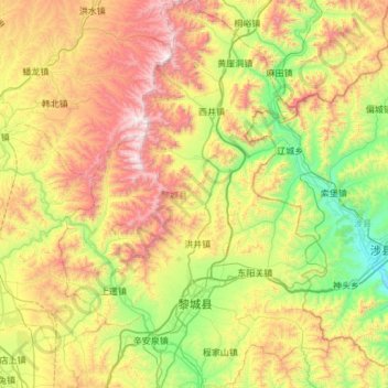
Name: 黎城县 topographic map, elevation, terrain.
Location: 黎城县, 长治市, 山西省, 中国 (36.39596 113.16775 36.87916 113.58840)
Average elevation: 1,018 m
Minimum elevation: 418 m
Maximum elevation: 1,983 m
Other topographic maps
Click on a map to view its topography, its elevation and its terrain.