
Thornleigh topographic map
Interactive map
Click on the map to display elevation.
Thornleigh
Thornleigh is bounded to the north by Waitara Creek and south by the Lane Cove National Park. Thornleigh borders the suburbs of Normanhurst, Hornsby, Wahroonga, Westleigh and Pennant Hills. Thornleigh offers great district views, and the topography varies greatly with many established areas built around bushland settings and into the hills to afford the great views. The northern areas of the suburb bounded by Larool Creek and Waitara Creek are leafy and lush with vegetation and native fauna including rainbow lorikeets, kookaburras, cockatoos, and bush turkeys. Majorie Headen Lookout is a vantage point which overlooks Larool and Waitara Creek Valley. The area bounded near the train station and the Comenarra Parkway include early examples of Federation and Californian Bungalow style properties.
About this map
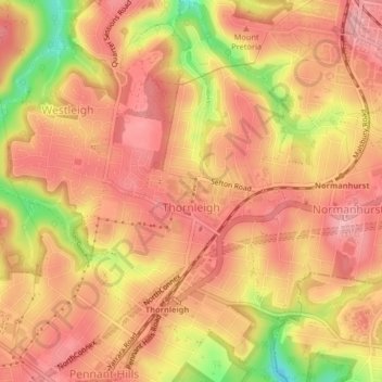
Name: Thornleigh topographic map, elevation, terrain.
Average elevation: 159 m
Minimum elevation: 72 m
Maximum elevation: 197 m
New South Wales trails, hiking, mountain biking, running and outdoor activities
Other topographic maps
Click on a map to view its topography, its elevation and its terrain.