
Warley topographic map
Interactive map
Click on the map to display elevation.
About this map
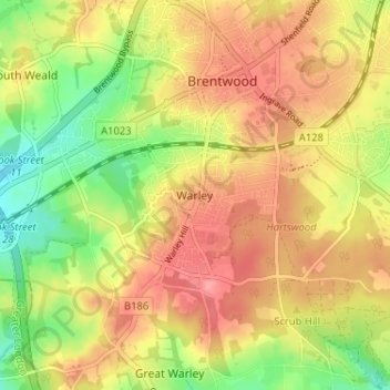
Name: Warley topographic map, elevation, terrain.
Location: Warley, Brentwood, Essex, England, CM14 5HH, United Kingdom (51.58840 0.27726 51.62840 0.31726)
Average elevation: 86 m
Minimum elevation: 38 m
Maximum elevation: 124 m
Other topographic maps
Click on a map to view its topography, its elevation and its terrain.