
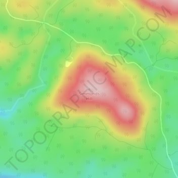
Simmonds Hill topographic map
Interactive map
Click on the map to display elevation.
About this map
Name: Simmonds Hill topographic map, elevation, terrain.
Location: Simmonds Hill, Tasman, Tasmania, Australia (-43.12351 147.91369 -43.12341 147.91379)
Average elevation: 189 m
Minimum elevation: 78 m
Maximum elevation: 333 m
Tasmania trails, hiking, mountain biking, running and outdoor activities
Other topographic maps
Click on a map to view its topography, its elevation and its terrain.