
Bilgola Plateau topographic map
Interactive map
Click on the map to display elevation.
Bilgola Plateau
The suburb is mainly residential, with two small rows of shops, a small park and a primary school located on the top of the plateau. Bilgola Beach on the eastern side features a surf club and kiosk. Rising to an elevation of 150m above sea level, the suburb has views of the beach and the ocean on the eastern side, and views of the body of water, Pittwater on the western side. To the north are the suburbs of Avalon Beach, Whale Beach, and Palm Beach, with Careel Bay being a minor bay in between the latter two, as well as Clareville to the North West. To the south are Newport, Mona Vale and Narrabeen.
About this map
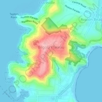
Name: Bilgola Plateau topographic map, elevation, terrain.
Average elevation: 37 m
Minimum elevation: -2 m
Maximum elevation: 151 m
New South Wales trails, hiking, mountain biking, running and outdoor activities
Other topographic maps
Click on a map to view its topography, its elevation and its terrain.