
Lawson topographic map
Interactive map
Click on the map to display elevation.
Lawson
In 1931, the Railway Department agreed to supply electricity to the Blue Mountains Shire Council. Power lines were constructed between Blackheath and Lawson, accompanied by a maintenance track. The authorities then decided to promote the maintenance track as a walking trail; it became known as Bruce's Walk, after the surveyor who planned it. The track later became neglected and forgotten, until it was rediscovered and improved by bushwalkers in the 1980s. It can now be followed from Medlow Bath to the north side of Lawson, although it is not shown on the relevant topographic map.
About this map
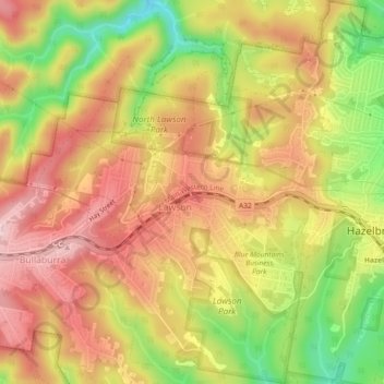
Name: Lawson topographic map, elevation, terrain.
Average elevation: 684 m
Minimum elevation: 535 m
Maximum elevation: 790 m
New South Wales trails, hiking, mountain biking, running and outdoor activities
Other topographic maps
Click on a map to view its topography, its elevation and its terrain.