
Woodford topographic map
Interactive map
Click on the map to display elevation.
Woodford
Woodford is a village in the Blue Mountains in New South Wales, Australia, about 90 kilometres west of Sydney. Its elevation is 609 metres (1,998 ft) above sea level. It is situated on the Great Western Highway and has a railway station (opened in 1868 as Buss's Platform) on the Main Western railway line served by NSW TrainLink's Blue Mountains services. At the 2016 census, Woodford had a population of 1,934.
About this map
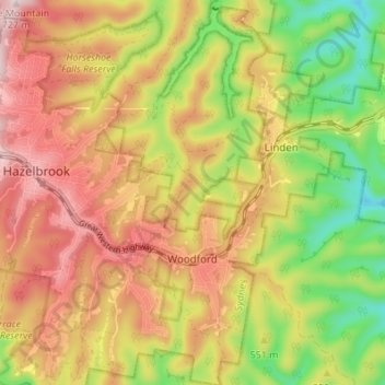
Name: Woodford topographic map, elevation, terrain.
Average elevation: 544 m
Minimum elevation: 360 m
Maximum elevation: 708 m
New South Wales trails, hiking, mountain biking, running and outdoor activities
Other topographic maps
Click on a map to view its topography, its elevation and its terrain.