
Tilicho Lake topographic map
Interactive map
Click on the map to display elevation.
About this map
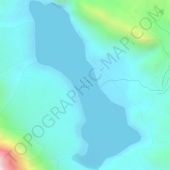
Name: Tilicho Lake topographic map, elevation, terrain.
Location: Tilicho Lake, Neshyang-09, Neshyang, मनाङ, Gandaki, Népal (28.67386 83.83970 28.70828 83.86562)
Average elevation: 5,062 m
Minimum elevation: 4,903 m
Maximum elevation: 6,079 m
Le lac Tilicho est un des lacs les plus hauts du monde. Il se situe à 4 919 m d'altitude dans la région des Annapurna dans le massif de l'Himalaya au Népal. Il a été découvert par l'expédition d'alpinisme française de 1950 à l'Annapurna, qui effectuait alors une reconnaissance pour trouver les voies d'accès vers le sommet. Les cartes de la région, encore très sommaires, ont ensuite été redessinées et fait apparaître le lac.
Other topographic maps
Click on a map to view its topography, its elevation and its terrain.