
Nashong topographic map
Interactive map
Click on the map to display elevation.
About this map
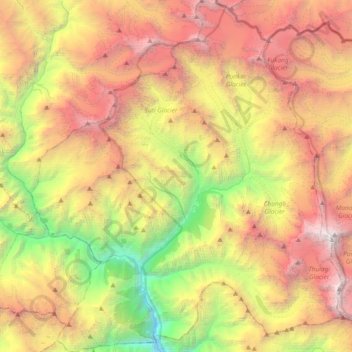
Name: Nashong topographic map, elevation, terrain.
Location: Nashong, मनाङ, Gandaki, 33500, Népal (28.44496 84.24118 28.77205 84.57149)
Average elevation: 4,661 m
Minimum elevation: 1,663 m
Maximum elevation: 8,035 m
Other topographic maps
Click on a map to view its topography, its elevation and its terrain.
Tilicho Lake
Tilicho Lake, Neshyang-09, Neshyang, मनाङ, Gandaki, Népal
Average elevation: 5,062 m