
Lincoln County topographic map
Interactive map
Click on the map to display elevation.
About this map
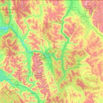
Name: Lincoln County topographic map, elevation, terrain.
Location: Lincoln County, Montana, VS (47.89005 -116.04923 49.00099 -114.61204)
Average elevation: 1,283 m
Minimum elevation: 536 m
Maximum elevation: 2,629 m
Other topographic maps
Click on a map to view its topography, its elevation and its terrain.
Glacier National Park
Glacier National Park, Sperry Lake, Flathead County, Montana, VS
Average elevation: 1,594 m
Robinson Park
Robinson Park, Helena, Lewis and Clark County, Montana, VS
Average elevation: 1,219 m