
中堂镇 topographic map
Interactive map
Click on the map to display elevation.
About this map
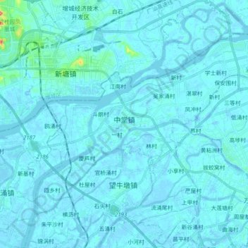
Name: 中堂镇 topographic map, elevation, terrain.
Location: 中堂镇, 东莞市, 广东省, 中国 (23.04145 113.59570 23.14493 113.74974)
Average elevation: 5 m
Minimum elevation: -13 m
Maximum elevation: 114 m
Other topographic maps
Click on a map to view its topography, its elevation and its terrain.