
东莞市 topographic map
Interactive map
Click on the map to display elevation.
About this map
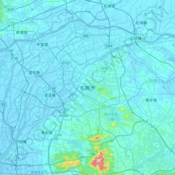
Name: 东莞市 topographic map, elevation, terrain.
Location: 东莞市, 广东省, 523058, 中国 (22.86060 113.58578 23.18060 113.90578)
Average elevation: 20 m
Minimum elevation: -10 m
Maximum elevation: 510 m
Other topographic maps
Click on a map to view its topography, its elevation and its terrain.