
Jeonju-si topographic map
Interactive map
Click on the map to display elevation.
About this map
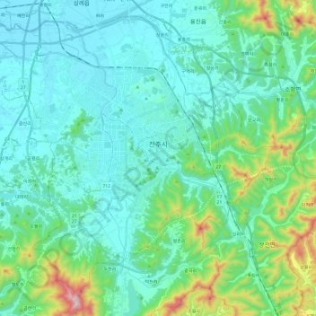
Name: Jeonju-si topographic map, elevation, terrain.
Location: Jeonju-si, Jeonbuk State, South Korea (35.72848 126.99619 35.90132 127.23437)
Average elevation: 137 m
Minimum elevation: 2 m
Maximum elevation: 764 m
Other topographic maps
Click on a map to view its topography, its elevation and its terrain.