
Hwaseong-si topographic map
Interactive map
Click on the map to display elevation.
About this map
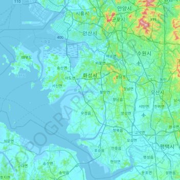
Name: Hwaseong-si topographic map, elevation, terrain.
Location: Hwaseong-si, Gyeonggi, South Korea (37.00239 126.50652 37.30877 127.16209)
Average elevation: 33 m
Minimum elevation: -4 m
Maximum elevation: 541 m
Other topographic maps
Click on a map to view its topography, its elevation and its terrain.