
Dwaliro topographic map
Interactive map
Click on the map to display elevation.
About this map
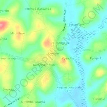
Name: Dwaliro topographic map, elevation, terrain.
Location: Dwaliro, Kassanda, Central Region, Uganda (0.53103 31.80193 0.57103 31.84193)
Average elevation: 1,215 m
Minimum elevation: 1,183 m
Maximum elevation: 1,282 m
Other topographic maps
Click on a map to view its topography, its elevation and its terrain.