
Altanbulag topographic map
Interactive map
Click on the map to display elevation.
About this map
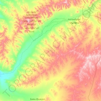
Name: Altanbulag topographic map, elevation, terrain.
Location: Altanbulag, Töw, Mongolei (47.05993 105.49219 47.85025 106.72465)
Average elevation: 1,365 m
Minimum elevation: 1,062 m
Maximum elevation: 1,890 m
Other topographic maps
Click on a map to view its topography, its elevation and its terrain.