
Khibang topographic map
Interactive map
Click on the map to display elevation.
About this map
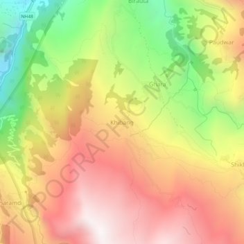
Name: Khibang topographic map, elevation, terrain.
Location: Khibang, Ghara, Annapurna, म्याग्दी, Gandaki, Népal (28.43111 83.62984 28.47111 83.66984)
Average elevation: 1,955 m
Minimum elevation: 1,125 m
Maximum elevation: 2,647 m
Other topographic maps
Click on a map to view its topography, its elevation and its terrain.
Dhaulagiri
Dhaulagiri, Mudi, Dhaulagiri, म्याग्दी, Gandaki, Népal
Average elevation: 7,321 m