
Darbang topographic map
Interactive map
Click on the map to display elevation.
About this map
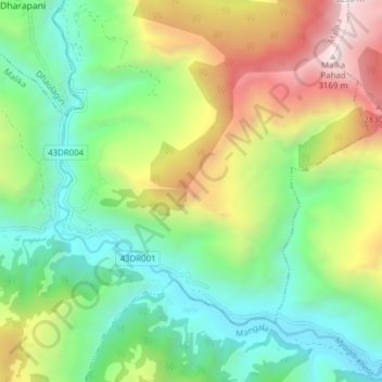
Name: Darbang topographic map, elevation, terrain.
Location: Darbang, Malika, म्याग्दी, Gandaki, 33208, Népal (28.39629 83.38154 28.44390 83.45884)
Average elevation: 1,744 m
Minimum elevation: 967 m
Maximum elevation: 3,205 m
Other topographic maps
Click on a map to view its topography, its elevation and its terrain.